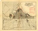
| Date: | 1907 |
|---|---|
| Description: | This map of Superior and the vicinity shows selected company properties, railroads, and roads in a portion of Douglas County. The map reads: "Copyrighted 1... |

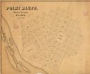
| Date: | 01 01 1856 |
|---|---|
| Description: | This map is mounted on cloth and shows lots, as well as location of the public square and college. Streets are labeled as is the Wisconsin River. |

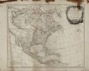
| Date: | 1790 |
|---|---|
| Description: | An updated and corrected version of Robert de Vaugondy's 1750 map "Amérique Septentrionale: Dressée sur les Relations les Plus Modernes des Voyageurs et Na... |

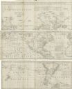
| Date: | 1775 |
|---|---|
| Description: | This six sheet large format map is one of the most informative maps of its time. It shows cities, Native American land, lakes, rivers, mountains, topograph... |
If you didn't find the material you searched for, our Library Reference Staff can help.
Call our reference desk at 608-264-6535 or email us at: